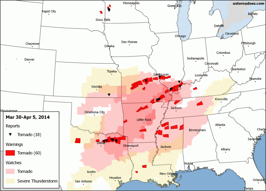
Looking back at the week of March 30-April 5.

It was a wild week of weather, with even a predominantly cold storm producing some action. Two significant systems rolled across the country. The first was the cold one, with blizzard conditions spread across the north central U.S.
The second, while also featuring snow in the northern Plains and Midwest, promised to be the first legitimate tornado event of the spring. While it did produce, it may be said it did so on the lower end of potential.
Still, a number of tornadoes occurred on multiple days, with a focus on the Ozarks and mid-South, but also targeting the broader Dallas-Fort Worth metroplex.
March 31 – Northern Plains blizzard’nado
The big story to start the week was that winter wasn’t leaving without a fight. Alas, tornadoes happened. Social media was abuzz over a tornado warning in a blizzard warning zone.
Tornado AND Blizzard warning in effect for eastern SD pic.twitter.com/e9PHcSmKVZ
— Jonathan Kegges (@JonathanKegges) March 31, 2014
Of course, the storm happened before the blizzard — though not by much. Nothing but barbed wire and oil out there.
Tornado Warning and hail within 60 miles of a blizzard. Wild weather in SD today! pic.twitter.com/ZEOnj5NLLS
— Rob White (@svrwxtweets) March 31, 2014
At least several weak funnels from high based storms showed up across Minnesota, as did future storm chasers.
Just saw a fucking tornado form outside of St. Leo!!!! Holy shit! pic.twitter.com/YAIoqtbJj5
— Brandy Wickstrom (@bwicky777) March 31, 2014
April 1 – The storm chaser day
Supercell forming conditions were increasingly good as strong mid-level winds from the western trough began to overshoot the southern Plains. But, the cap was strong. Chasers flocked, because that’s what we do.
…and then the HRRR tries to prove me wrong. Two nice supercells on the Red River @ 01z. #okwx #twx pic.twitter.com/1GMw19nSZJ
— Bart Comstock (@SvrWxChaser) April 1, 2014
Not much love for the northern slight risk from the spotters & chasers today. pic.twitter.com/bD9sPj387l
— WeatherWary LLC (@WeatherWary) April 1, 2014
Intense tornado-warned supercell in Throckmorton County, TX…warning until 8pm CDT. Wall cloud reported. pic.twitter.com/8zZS18sKvl
— Nicholas Humphrey (@NickHumphreyWx) April 2, 2014
View of the lowered area of the tornado-warned storm SSW of Throckmorton earlier. Delayed by poor cell coverage #txwx pic.twitter.com/zY4Co8mj3s
— Eugene Thieszen (@WXtremeChaser) April 2, 2014
April 2 – Can’t root to the warm front
Sometimes before tornado outbreaks there’s a “day before the day.” That’s what this one looked like if it could hit potential. Fortunately for those in the region, it did not.
225pm-Here are our current thoughts for storm initiation late aftn/early evening. #okwx #texomawx pic.twitter.com/laBUwdCqNS
— NWS Norman (@NWSNorman) April 2, 2014
Rotation strengthening 10 miles west of Chanute #KSwx @NWSWichita pic.twitter.com/a2rNtBaA9i
— Chad Cowan (@stormtimelapse) April 2, 2014
Storms initiating in southeastern Kansas now. The cell in far eastern Kansas is severe thunderstorm warned. #kswx pic.twitter.com/fYNIXslz1f
— Mike DeLeonardis (@ecography) April 3, 2014
This thing is just exploding!!! @skewy11 looking east toward Cedarvale, KS #kswx #clouds @KAKEweather @KWCH12 pic.twitter.com/CmXbwtgsHw
— Nicole Loeffler (@chaserchick17) April 3, 2014
April 3 – Small-scale outbreak and some scary moments
The day started with an EF1 tornado ripping through parts of St Louis, MO, and a moderate risk was on the table for the day. By and large the event trended toward the low end of the initial risk, but try telling that to places like Denton, Tx where multiple supercells dropped giant hail and created quite the tornado scare.
In the end, roughly 10 tornadoes were produced, including at least three in north Texas and two in southern Illinois.
Incredibly dangerous storm with with a reported funnel cloud about to move into Denton, TX. Take cover! #txwx pic.twitter.com/h9aUFYkcGq
— Jennifer Watson (@JWatson_Wx) April 3, 2014
Over Denton now pic.twitter.com/O6p2iEFK3U
— Amos Magliocco (@amosmagliocco) April 3, 2014
3d view of the tornado warned supercell near Farmersville, TX. pic.twitter.com/3V7tUfFBhl
— U.S. Tornadoes (@USTornadoes) April 4, 2014
This week’s action
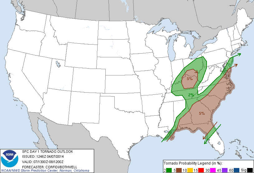
The week is already off to a fast start when it comes to tornadoes thanks to a storm system wrapping up over the South this morning. A dozen tornado warnings were issued overnight, with at least several tornadoes suspected in Mississippi. A threat will continue in the southeast and Ohio Valley today.
Related: Tornado Threat Forecast: April 6-7, 2014

Behind this storm system, it may be a rather quiet week as the country is dominated by cool and dry air until close to next weekend. New storm threats may emerge around then, but details are foggy as to if and where.
Latest posts by Ian Livingston (see all)
- Busy March for twisters to end with another multi-day event - March 28, 2025
- Everything but locusts: NWS shines in apocalyptic weather - March 17, 2025
- Top tornado videos of 2023 - January 1, 2024


Good writeup! Hopefully things will be active enough when the Hokie Stormchasers head west in mid-May!
The quiet start worked out well for mid-May chasecations last year so perhaps there’s that. 😉