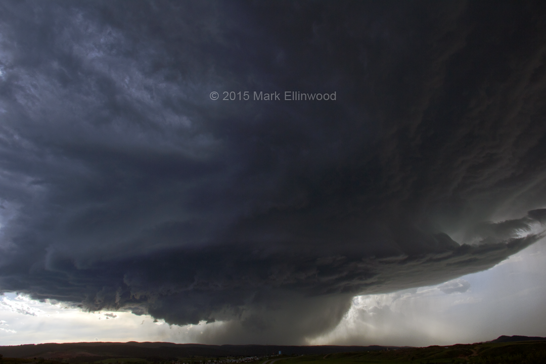
Today brought us to the Rapid City, South Dakota area on the northern end of the Black Hills. A brilliant supercell eventually appeared over the Black Hills, though good vantage points to see it well were difficult to find due to the terrain.
The next couple of days hint at more possible tornado activity after a lull over the past several days. The threat areas will be focused over the northern and central Plains, and there is a possibility of a more enhanced threat in the central Plains on Wednesday.
Here’s one shot of today’s supercell that just sat over the Rapid City area for a few hours.
It's peak tornado season. We briefly examine the top outbreaks from April-June.
A dip in the jet stream is blasting toward the central United States and poised…
A historic storm system swept through the central, southern and eastern U.S. from Friday through…
In a field historically dominated by men, Jen Walton has emerged as a transformative figure…
Jason Persoff, MD, SFHM, is recognized globally for his expertise in storm chasing. He earned…
Tornado numbers were near or above average. A chase season peak in June provided numerous…