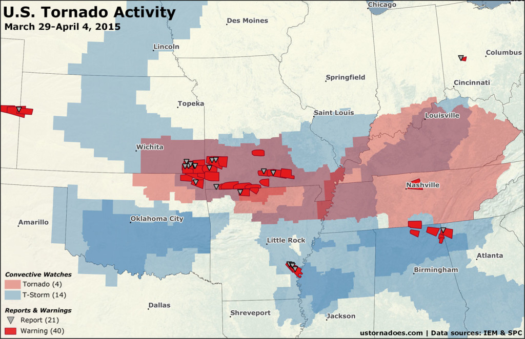
Tornado highlights covering the week of March 29-April 4, and a brief look ahead.
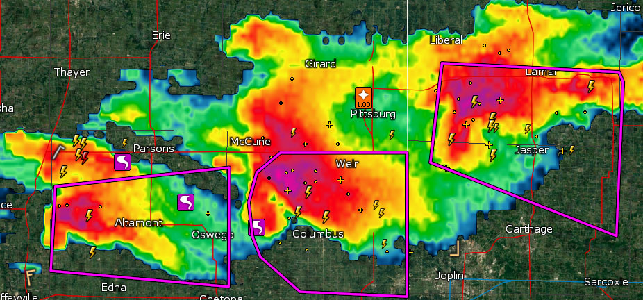
Here we go again. The historical peak of the tornado year has arrived, and it usually runs through June. Given that the period often has regular storminess, Tornado Digest returns for its weekly run over the next few months.
Severe weather has already awakened. Despite the exceptionally quiet start to the year across the country, both of the last two weeks have featured systems creating big thunderstorms and dropping tornadoes.
The outlook ahead appears to indicate the calendar is finally taking over, and tornado numbers are likely to be on the rise. A multi-day run of severe weather, including the risk for tornadoes, is increasingly probable during the week ahead.
Note: This is the first regular Tornado Digest for 2015. They’ll run weekly as a recap through June (perhaps not including the two weeks while chasing!).
While the week just finished was hardly exceptional when it comes to storminess this time of year, there was a notable pick up in consistency. 18 convective watches (severe thunderstorm or tornado) were issued during the week. That’s 70 percent of all the watches so far this year.
Tornadoes were reported on three days from two different systems. Four tornado watches were issued along with 40 tornado warnings. There were 21 filtered reports of tornadoes as of publish.
March 31: Arkansas
Tornado Warning including Arkansas County, AR until 3:00 PM CDT pic.twitter.com/ysLlhQSlbg
— NWS Tornado (@NWStornado) March 31, 2015
A supercell that was part of a larger regional severe weather event cruised across central and southeast Arkansas. Four tornado reports came from this storm.
April 2: Southern Plains, Midwest
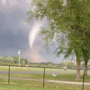
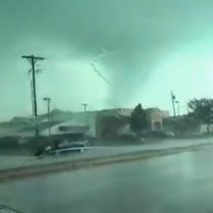
Almost exactly a week after the first moderate risk of the year on March 25, storms ripped across the Plains once again.
Brief Tornado near Labette, KS storm is moving southeast towards Oswego, KS pic.twitter.com/YymNWbj3gL
— Micah Hart (@MicahHartWx) April 3, 2015
https://twitter.com/BDMphoto/status/584001920156598273
It was one of the most active days of the year so far for tornadoes.
At least six touched down in Missouri, two or three in Kansas, one in northeast Oklahoma, at least one in Arkansas, and one further removed in Ohio.
April 3: Tennessee, Kentucky, Mid-South
April 3 one was mostly a bust, at least on the tornado angle. Too much cloudiness, too many storms, not enough instability. Not too uncommon for early in the season.
Tornado probabilities are fairly high in watch box. Worth paying attention to in area. Risk for strong tornadoes. pic.twitter.com/UCfyAnedqU
— U.S. Tornadoes (@USTornadoes) April 3, 2015
Enhanced tornado risk was present across parts of Kentucky and Tennessee. Several tornado watches were issued, and the risk for intense tornadoes was noted. Only one tornado warning was issued within the tornado watches.
Tornado debris signature (TDS) on dual pol on the AL/TN state line north of New Market pic.twitter.com/wHRYox7tBx
— James Spann (@spann) April 4, 2015
A later set of warned storms near the Alabama and Tennessee border did spawn at least one tornado.
A good read: April 3 Severe Weather Bust http://t.co/cILq5lL8CH via @wxornotbg
— Jacob Wilkins (@JacobWilkinswx) April 4, 2015
Revving up?
A brief look at the week ahead
April begins peak season when it comes to tornadoes. It’s a month well known for its painful outbreaks. Despite recent quiet times, it should not be unexpected that severe weather is in the offing ahead.
But this one could be a doozy.
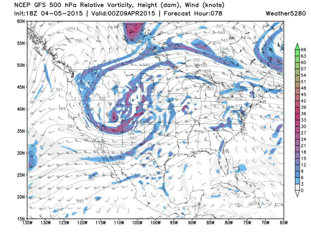
A West Coast storm system (they still do exist!) is expected to push out into the Plains during the midweek before heading eastward from there.
It’s likely that at least a day or two could have high-end potential depending on how this storm leaves the mountains. Additional severe weather is possible on either side of the two bigger days that are presently expected to be Wednesday and Thursday.
Analog guidance and pattern recognition suggest there’s a very good chance of a significant severe weather episode, including the threat for long-tracked and strong tornadoes.
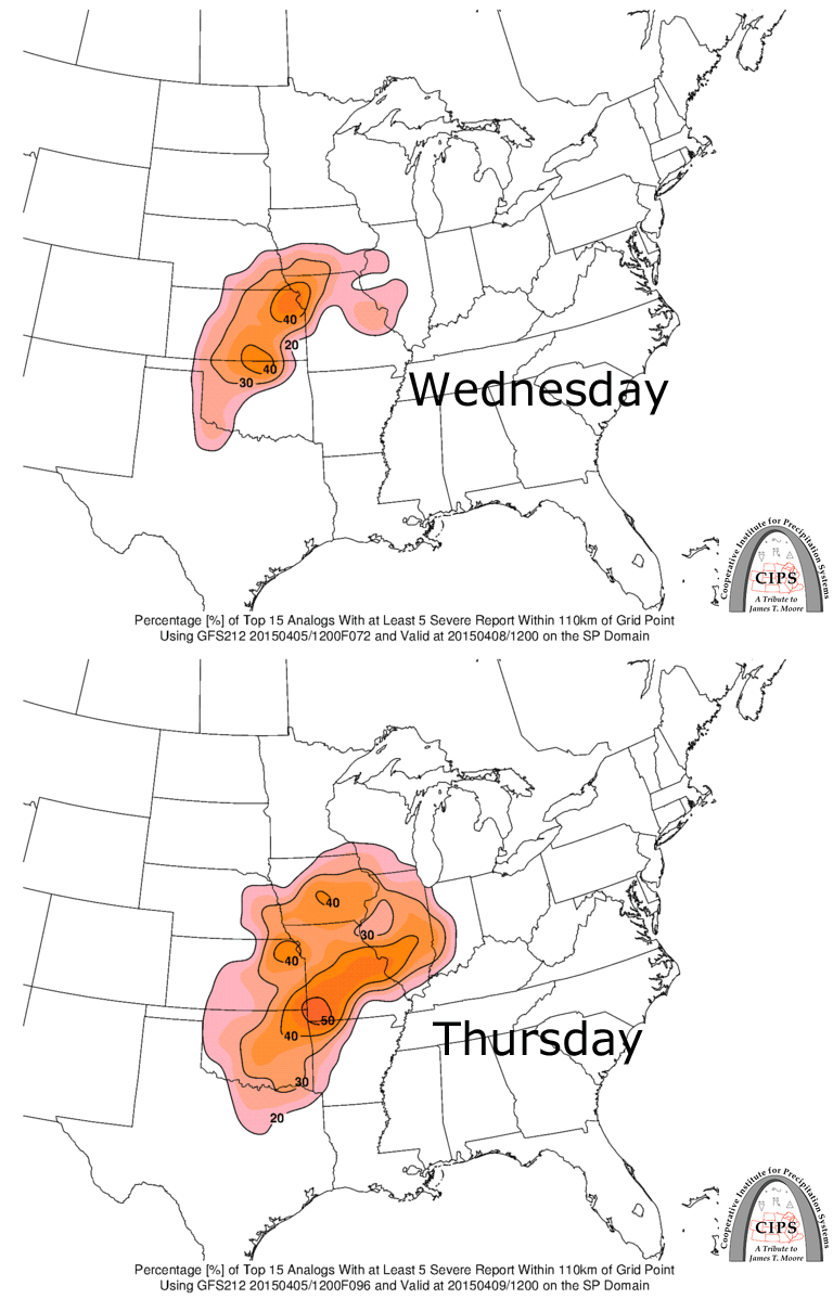
The idea above — showing likelihood of severe storm reports based on analogs — is built off top matches from today’s GFS model run. It’s pretty much in line with SPC’s thoughts on the period from this morning. Modeling has been somewhat consistently foreboding considering the range.
Many details are yet to be worked out, including some which could keep the event lower end, but in a lot of ways it’s looking like a classic springtime tornado and severe weather event as we see it from here. Do also keep in mind where tornadoes tend to hit in April as we close.
Mark will be along with a tornado threat forecast soon as well. In the meantime, there’s some great detailed discussion going on over at Stormtrack and also AmericanWx.
Latest posts by Ian Livingston (see all)
- Busy March for twisters to end with another multi-day event - March 28, 2025
- Everything but locusts: NWS shines in apocalyptic weather - March 17, 2025
- Top tornado videos of 2023 - January 1, 2024
