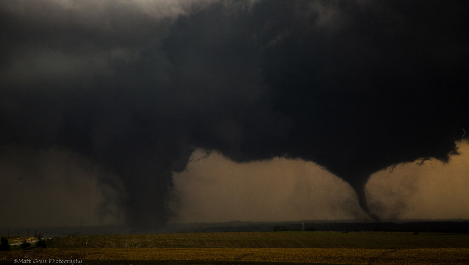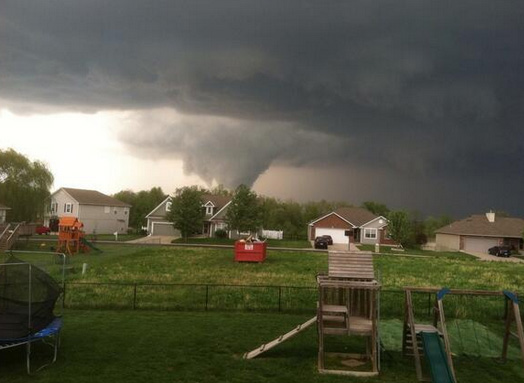
Astronomical summer began in a way summer tends to trend, quieter than times prior when it comes to tornado activity.
Tornadoes were reported across the country on all but one day of the week last week. But, in general, everything was minor and geographically isolated.
While events ongoing early this week remind us that decent tornado activity can continue well into the summer, we’ve certainly moved out of usual peak, and the overall outlook calls for less and less shear to support significant tornado events going forward in the times ahead.
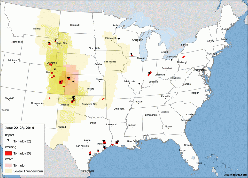
Note: This will be the final regular weekly Tornado Digest until April-June of 2015, since tornado activity is often not consistent enough outside these months to support it weekly. However, we will run them as needed (for significant events or strings of active days throughout a week) during other times of the year. It’s possible that includes a recap of this week once all is said and done.
June 22: High Plains
On the 22nd, a beastly high precipitation supercell was the main show of the day as it slinked south through parts of the Oklahoma and Texas panhandles. The storm produced at least six weak and short lived tornadoes, the strongest rated EF-1.
@nwsmet First tornado here. That white cone at the front edge stretched and briefly touched down. @WXtremeChaser pic.twitter.com/7BJxmds4YP
— TornadoTitans.com (@TornadoTitans) June 23, 2014
June 23: Illinois and Ohio
In Illinois, a brief and weak landspout tornado was witnessed in Wayne County. Later in the evening, a storm without a tornado warning dropped an EF1 that caused some significant damage in and near Brunswick, Ohio.
Here's a shot of the landspout that occurred in Wayne County a couple hours ago. pic.twitter.com/vf9FD7ydPF
— Nick Hausen – WSIL (@NickHausenWSIL) June 24, 2014
Brunswick tornado from Lynna Lai on Vimeo.
June 24: Indiana
During the midday, a storm passed through areas southwest of Indianapolis and into parts of the city itself, dropping three weak tornadoes along the way.
New Tornado Warning (spotter confirmed tornado) WSW of Indianapolis, heading northeast. pic.twitter.com/llAh5vruA4
— U.S. Tornadoes (@USTornadoes) June 24, 2014
Plainfield, Indiana. Via Andrew Newcomb/Live Storms Media.
June 25-27: High Plains and Gulf Coast
A smattering of tornadoes were reported each day, mainly in portions of the High Plains and near the Gulf Coast. On the 26th, at least one EF0 struck a mobile home park near Galveston and on the 27th, several weak tornadoes were spotted in Louisiana.
Further northeast on the 27th, an EF1 tornado passed through Colfax in Wisconsin.
Several landspouts like the one below were also seen in Kansas that day.
Another photo of the tornado/landspout south of Brewster (5:49 pm CDT) #kswx pic.twitter.com/caE2pFEVKX
— Jason Keller (@jasonkellerpt) June 27, 2014
Into the dog days of summer?
A vigorous late-season surge of winds aloft continues to move through the country today and its impacts are likely to be felt further east in the days ahead. After that, maybe feeling more like summer.
The last time we saw a MOD risk area for tornadoes was two weeks ago when the Pilger NE twin tornadoes occurred, among others in the region. Today has started off quite ripe, but a big question is how quick we’ll transition to mainly a linear mode with damaging winds the main threat.
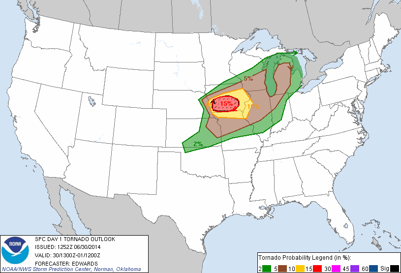
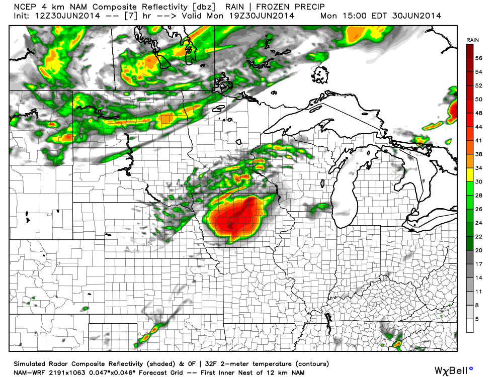
Once past today, any more significant tornado threat should wane with this system. In its wake we generally see the jet stream relegated to near the northern international border in locations to the west of the Mississippi River (plus a tropical system off the East Coast).
It’s too soon to say whether or not this becomes established central U.S. ridging that effectively cuts off any widespread tornado threat for most of the country as is typical in summer. We should also remember that the northern Plains as well as the northeast U.S. enters into its peak tornado season in July, so some threats are sure to surface in addition to the still regular extremely isolated spin-up common to the weeks ahead.
Latest posts by Ian Livingston (see all)
- Busy March for twisters to end with another multi-day event - March 28, 2025
- Everything but locusts: NWS shines in apocalyptic weather - March 17, 2025
- Top tornado videos of 2023 - January 1, 2024
