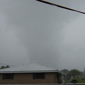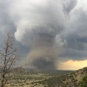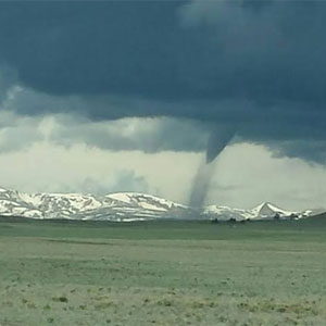
We kicked off the second week of June with a tornado outbreak in one of the few spots that has had an active tornado season this year, Colorado.
Following the Sunday outbreak, a few quieter days ensued, but it was another week with tornado reports every single day. Among other typical places, a tornado occurred in the hills of Pennsylvania, and a more widespread threat closed the week in the Plains.
More tornadoes are a good bet today, mainly across parts of the eastern Plains and upper Midwest. And this system won’t be in a hurry to move after today either.
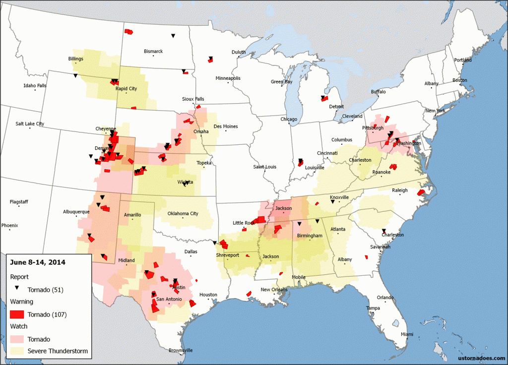
June 8: Colorado and down the Front Range
A small-scale tornado outbreak hit Colorado, with additional tornadoes reported further south along the Front Range. At least nine tornadoes have been confirmed across northeast parts of CO, according to the NWS there. Three of these tornadoes occurred well into the mountains, at elevations of 8,000-10,000 feet. One near Lake George was rated an EF2, while all others were weak. Lots of proof this year that tornadoes do indeed happen in mountains.
Related: Tornadoes in June Not Uncommon for Colorado
Taken just east/north of Hartsel around 11am by Laura Rhodes. Snow capped mountains and #tornado #cowx pic.twitter.com/lzH9XCgj4n
— Brian Bledsoe (@BrianBledsoe) June 8, 2014
This photo was taken by a friend of my aunt who lives in Woodland Park! #Tornado. #COwx pic.twitter.com/pY8sXlSRe7
— Marcelo Albuquerque (@COSpotter_MJA) June 8, 2014
Incredible photo of a tornado near Woodland Park, CO earlier today! #COwx [Via: Instagram/alaynataylor] pic.twitter.com/paHrwSqUl0
— Jacob DeFlitch (@WxDeFlitch) June 8, 2014
Tornado near Lake George, Colorado. Via tru wisdome on YouTube.
June 11: Mid-Atlantic and the Plains
The main tornado story of the day came from Pennsylvania, where a relatively unusual EF1 tornado tore a 12 mile path through the Pennsylvania mountains just north of Cumberland, Maryland. The twister formed within a tornado watch that included D.C., as well as another tornado warned supercell that I intercepted along with ustornadoes.com partners Mark Ellinwood and James Hyde. Other tornadoes were reported near Goodland, Kansas, San Angelo, Texas and in North Dakota.
A #tornado touched down about 2 miles east of Devils Lake, ND this afternoon. Didn't last long. #ndwx pic.twitter.com/qjyid2BaGf
— Aaron White (@AaronWhiteWDAY) June 11, 2014
Video still of the day: Tornado-warned storm near Inwood, WV on 6/11/14. pic.twitter.com/rvWfuN4Gd1
— Mark Ellinwood (@markellinwood) June 12, 2014
Emergency management confirmed a tornado on the ground in south central PA. Not every day that you see that pic.twitter.com/LzSjCKyPpc
— Steve Copertino (@TheSteveCop) June 11, 2014
Centerville, PA tornado. Via Uploads on YouTube.
June 12: Texas
A very unstable environment settled over central Texas on June 12, leading to a tornado watch for the area. Several supercells took advantage of the environment, with one in Burnet County spawning two tornadoes. The strongest was an EF2 that occurred between Watson and Shady Grove.
Amazing 3D view of a tornado warned supercell SE of Lampasas, TX. Warning goes till 8:30 CDT. #txwx pic.twitter.com/x3NXoC2cRo
— U.S. Tornadoes (@USTornadoes) June 13, 2014
Tornado near Watson, TX. pic.twitter.com/UYrSCyMyfh
— Jason Owens (@JasonLOwens) June 13, 2014
Tornado near Briggs and Watson, Texas. Via AllAccessWeather on YouTube.
June 13: Wyoming
A tornado touched down in northeast Wyoming amidst upslope flow and a short wave trough passing by. It was rated an EF2, and several chasers caught a glimpse of it from a distance.
Tornado west of Belle Fourche, SD. Tornado was in WY. pic.twitter.com/MPEOhvLG7I
— Bill Kessler (@BillKesslerUFD) June 14, 2014
Our tornado in rain that we witnessed, earlier this evening, near Aladdin, WY. @reedtimmerTVN @severestudios pic.twitter.com/po91ZuLU3A
— TornadoRaiders.com (@tornadoraiders) June 14, 2014
June 14: Central Plains
A moderate risk (for wind and hail) was issued for the central Plains, mainly including parts of Nebraska and Kansas. The tornado threat — as many this year — looked mostly solid, but was missing an ingredient or two in a number of cases. High based storms and storm modes headed linear fairly quickly limited the overall tornado threat. Landspouts or weak tornadoes were the rule of the day. Chris Sheen likely snapped the tornado picture of the year amid Nebraska’s evening light.
Stockton, KS! pic.twitter.com/e0k2tiGbmK
— Charles (@OWxPhotography) June 14, 2014
Beautiful tornado in NE earlier. By Chris Sheen south of Wilcox and Hildreth, via @SeanSchoferTVN pic.twitter.com/y9aKKDuqks
— U.S. Tornadoes (@USTornadoes) June 15, 2014
Franklin County, Nebraska tornado. Via Severe Studios/Ken Engquist on YouTube.
The week ahead
An upper-level trough in the Pacific Northwest and a belt of strong winds racing by to the south of it and into the Plains help set the stage for a severe weather outbreak today across areas like Nebraska, Iowa, South Dakota and Minnesota.
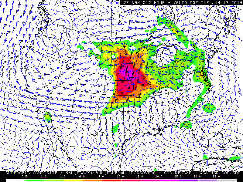
Severe threats may remain heightened for several days depending on how the upper-level system moves. It appears it will do so slowly one way or another.
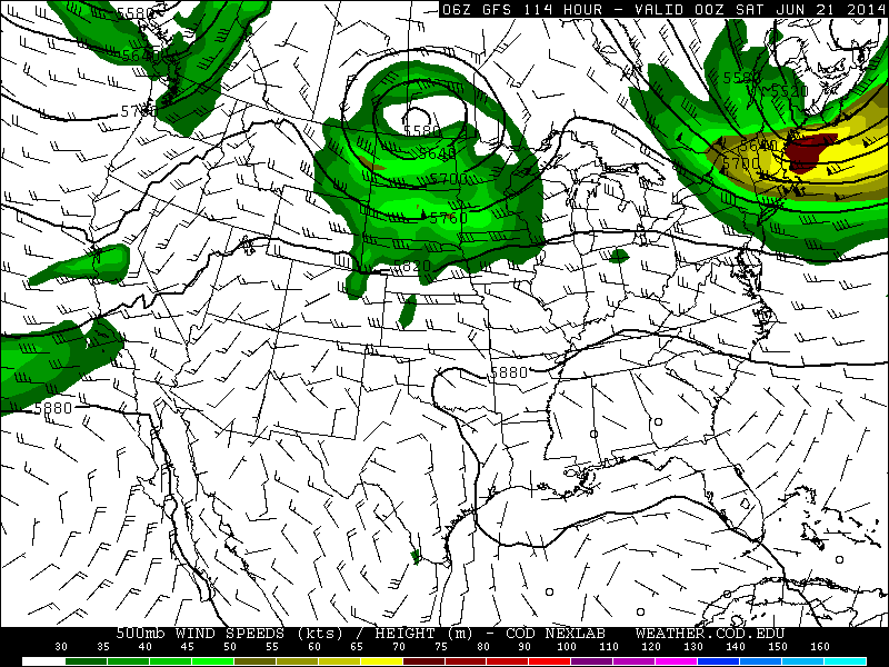
Depending on its ultimate track, at least low-level tornado threats could continue eastward across the northern U.S. late into the week or weekend.
Latest posts by Ian Livingston (see all)
- Top tornado videos of 2023 - January 1, 2024
- March 31, 2023 tornado outbreak videos - March 31, 2023
- Top tornado videos of 2022 - December 31, 2022
