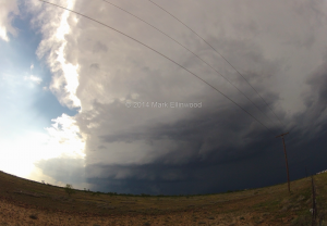
We followed that storm for a bit, then we dropped south along SR 87 along with the chaser horde as a new storm got tornado-warned. After tracking it south and east, we eventually dropped it south of Sterling City, TX. It passed by the main road while we were shooting some lightning, and after that we got into San Angelo and found a Sonic to park at while hail from the next storm overtook the town:
Yesterday had a little bit of everything when it comes to storms. Today we hope to get a more definitive tornado as it is probably our last chase day before driving back east. While the setup in ND/MT is tempting, it would take just as long to drive up there as it would take to drive back home, and the bust potential is a bit too high to want to make that drive north.
