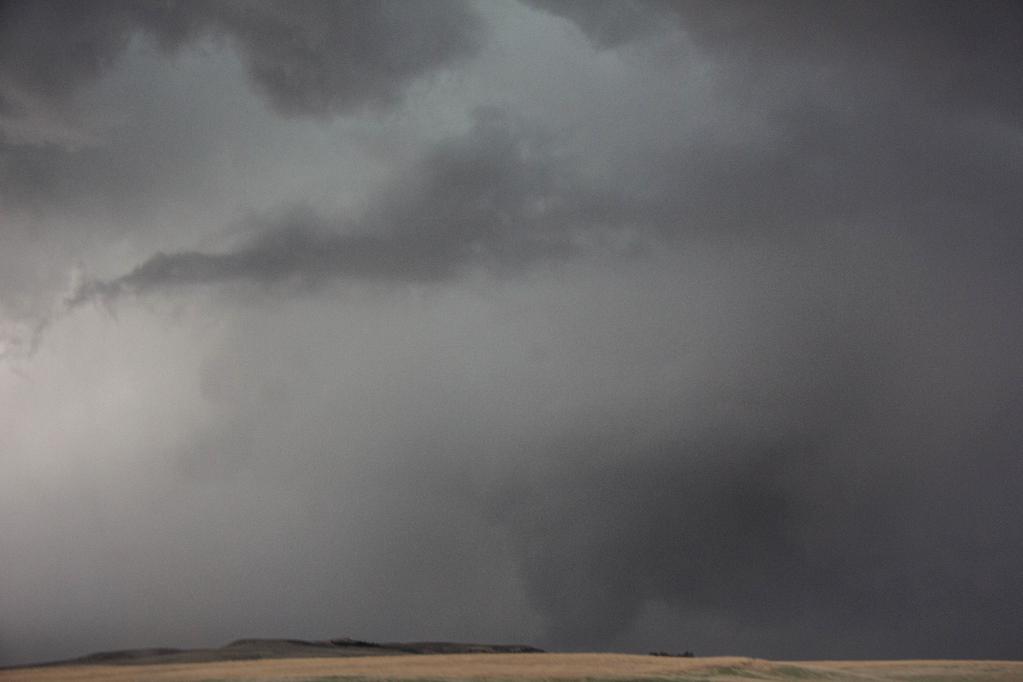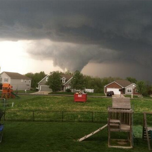
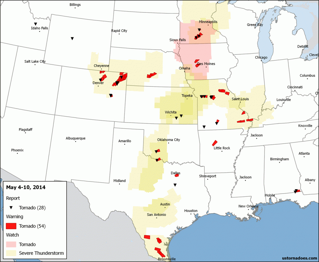
It was a fairly typical week in May, if on the light side when it comes to tornadoes. No massive outbreaks, but spinups formed on multiple occasions without too much effort.
Two separate storm systems traversed the country. The first in the middle of the week, and another bigger system to end the week.
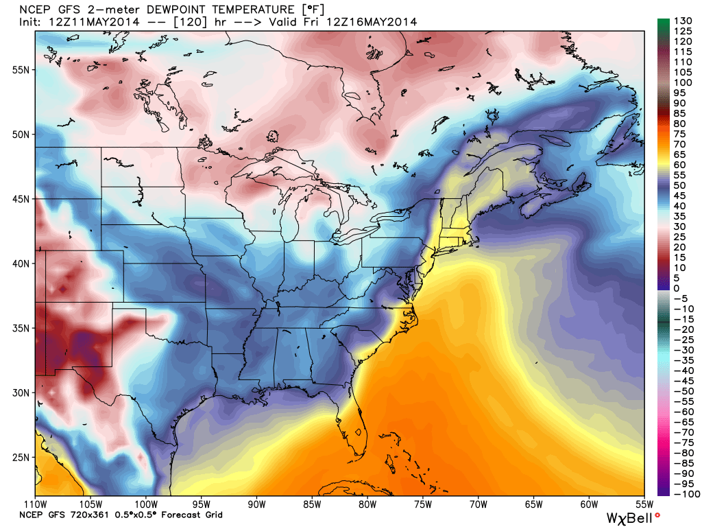
That bigger system is set to cause more problems today and tomorrow at the least. But, in its wake a generally unfavorable tornado environment takes over the country for 5-7 days or so before things might start to trend back toward what we usually see in May.
May 6 – Utah
Despite meager moisture, the work week started with several days of High Plains supercells beginning Monday in Montana. With a speedy band of winds aloft, any storms in the region that could find the right surface ingredients wanted to blow up and rotate. In Utah, a somewhat unusual supercell tornado touched down on the 6th.
Tornado north of #Riverton at 2:05pm today #wywx pic.twitter.com/VWIedYoF2S
— Kelly Allen (@WxAllen) May 6, 2014
@weatherchannel it even had a hook! pic.twitter.com/9tJVdaN1Nv
— Kelly Allen (@WxAllen) May 7, 2014
May 7 – Colorado and the Southern Plains
With a snowstorm looming later in the week, tornadoes threatened the Denver region and eastward mid-week thanks to a mid-level trough pushing into the Plains. Several weak tornadoes touched down in northeastern parts of the state as well as Oklahoma. A good chase day, and minimal impact to populated areas.
Tornado as seen from highway 63 south of Akron, CO at approx 4:05 mountain time #cowx pic.twitter.com/bEod2foRlh
— Jeff Stoecklein (@JeffStoecklein) May 7, 2014
Tornado in Wichita Mountains Wildlife Refuge earlier this evening. Image courtesy Shawn Komahcheet and @AustinKSWO pic.twitter.com/qvmyoiIxfT
— Rick Smith (@ounwcm) May 8, 2014
May 7 2014 Northeast Colorado Tornadoes from SevereWeatherResearch on Vimeo.
May 8 – Focus on Minnesota
This was a moderate risk day from the Storm Prediction Center, though it was on the high end of slight risk for tornado threats. At least two EF0 tornadoes were confirmed in MN. One near St. James and another northeast of Madelia (NWS report – PDF). A tornado warning was also issued for Dallas, Texas earlier in the day, possibly inducing a brief touchdown. At least two tornadoes were also confirmed in Missouri.
Dallas
Saw this cloud that sure looked like it was rotating 25 mins ago on I-30 at MacArthur. May have moved into #Dallas. pic.twitter.com/pOJe1L2VzH
— Marie Saavedra (@MSaavedraTV) May 8, 2014
Minnesota
4:50pm CT: Spotters confirm tornado on the ground S of St. James, #MN. Storm is moving NE at 30 mph. Take shelter! pic.twitter.com/FxQegs5mEP
— TWC Breaking (@TWCBreaking) May 8, 2014
May 9 – Plains into Midwest
The beginnings of the next western U.S. trough began to be felt on Saturday the 9th, and that helped set up a zone of tornado risk, primarily in eastern Kansas and into Missouri. Surveys from this system are still in the early stages, but it’s likely that at least half a dozen or so tornadoes occurred in the region. Other brief touchdowns happened in Alabama and Idaho (of all places!).
Just got this from my dad — near Buckner — stay connected to @kmbc pic.twitter.com/wt2SMlH02M
— Erin Little KMBC (@ErinLittleKMBC) May 10, 2014
Large wedge tornado 2 hrs ago near Marshall, MO.
@COPTERJOHN @WHOWEATHER @WXMEGS @WHOWeather @ABC5_WOI #MOwx pic.twitter.com/UieLxQHBuo
— Ricky Forbes (@ForbesRicky) May 11, 2014
Tornadoes today into early week, then more quiet
A vigorous mid-level storm is pushing out into the Plains today, promising to bring tornadoes to several regions, with a focus on Nebraska and Iowa as well as potentially down along the dry line into Kansas and Oklahoma.
Warm front looking primed for tornadic supercells this afternoon. Heads up! #newx #iawx pic.twitter.com/80YuK9bRaU
— Dr. Victor Gensini (@gensiniwx) May 11, 2014
After this system pushes east, it will slow considerably while also sending a cold front well into the Gulf of Mexico. That ends up providing a generally unfavorable tornado environment for most of the country as time progresses into next weekend. This includes the heart of the Plains, where the season is now pushing into average peak across the south-central region.
We’re headed out the door for our annual chasecation on Friday. So, we’re keeping our fingers crossed for more active times ahead after this week — preferably in the desolate high plains!
Latest posts by Ian Livingston (see all)
- Busy March for twisters to end with another multi-day event - March 28, 2025
- Everything but locusts: NWS shines in apocalyptic weather - March 17, 2025
- Top tornado videos of 2023 - January 1, 2024
