UPDATE 6/28:
I’m on storm watch again today, so there will be no update. See you all on Monday!
—–
Just a heads-up that Thursday is looking like a chase day for me, so the next forecast will be on Friday… part of the reason of why this post wasn’t on Monday.
…Okay, that was just an after-the-fact excuse because I was too lazy and tired to do it on Monday.
So bear with me on the 4-7 day forecast. An upper-level trough sitting over the Midwest and eastern U.S. will keep kicking off storms in the same general area, so rather than overlap the same area every day I just consolidated it into one.
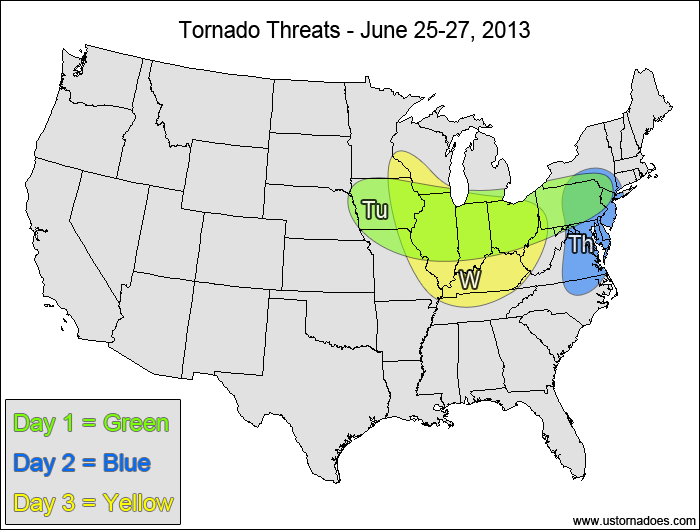
1-3 DAY
Midwest, northern Mid-Atlantic — POTENTIAL: Medium — CONFIDENCE: Normal
Pros: Low-level shear, moderate instability
Cons: Weak upper-level shear, no major forcing mechanism
Wednesday
Midwest — POTENTIAL: Medium — CONFIDENCE: Normal
Pros: Low-level shear, moderate instability, shortwave
Cons: Weak upper-level shear
Thursday
Mid-Atlantic — POTENTIAL: Medium — CONFIDENCE: Normal
Pros: Low-level shear, moderate instability, shortwave, deepening surface low
Cons: Weak upper-level shear
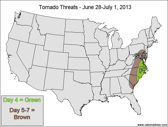
4-7 DAY
Eastern VA, eastern Carolinas — POTENTIAL: Low — CONFIDENCE: Normal
Pros: Low-level shear, moderate instability
Cons: Weak upper-level shear, weak mid-level lapse rates
Saturday through Monday
Mid-Atlantic, Carolinas — POTENTIAL: Low (for each day) — CONFIDENCE: Normal
Pros: Upper-level forcing, low to moderate instability
Cons: Weak lapse rates, weak low to mid level speed shear
Latest posts by Mark Ellinwood (see all)
- Spring 2023 seasonal tornado outlook - March 1, 2023
- Spring 2022 seasonal tornado outlook - March 1, 2022
- Spring 2021 seasonal tornado outlook - March 1, 2021


