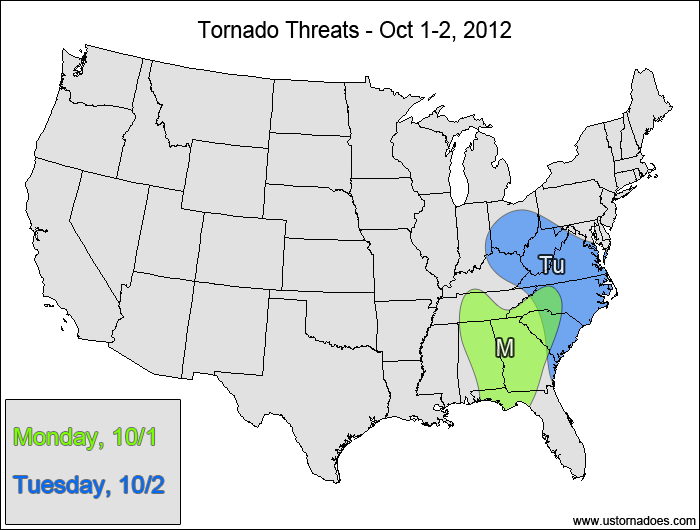
TODAY (Monday): Medium Risk
A weakening surface low will continue to trigger storms in the Southeast today, with fairly good shear and decent enough instability to allow for rotating storms capable of producing isolated tornadoes. What is currently the main line of storms moving through Georgia will continue to lift northeastward through the overnight hours, bringing the tornado threat with it. Further west, more storms will develop over Alabama and the Tennessee Valley that could potentially produce tornadoes into the overnight hours.
TOMORROW (Tuesday): Low Risk
Storms will struggle more to produce tornadoes as the main area of instability and wind shear separates from the upper-level dynamics. Weak height rises tonight going into tomorrow will also hinder tornadic development east of the mountains, and it could also inhibit storm formation itself after a morning batch of rain east of the mountains lifts off to the north.
The tornado threat may extend into Wednesday as the best CAPE/shear combo heads into the northern Mid-Atlantic, but there’s too much uncertainty with the setup with respect to lapse rates and instability to justify extending the forecast.
Latest posts by Mark Ellinwood (see all)
- Spring 2023 seasonal tornado outlook - March 1, 2023
- Spring 2022 seasonal tornado outlook - March 1, 2022
- Spring 2021 seasonal tornado outlook - March 1, 2021


