1-3 DAY
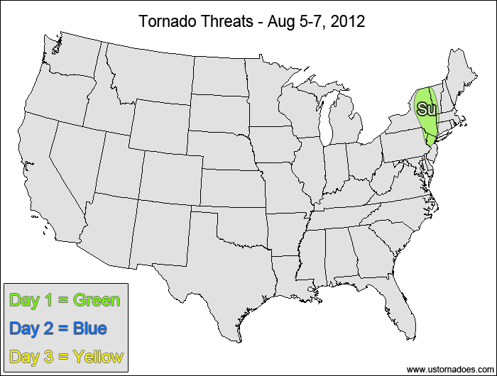
Northeastern Mid-Atlantic — POTENTIAL: Very Low — CONFIDENCE: High
Storms forming ahead of a cold front are in an environment with enough directional shear for a tornado, but speed shear and instability are on the low end.
Monday
No tornadic activity expected.
Tuesday
No tornadic activity expected.
4-7 DAY
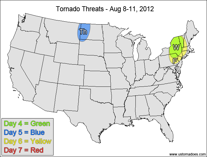
Northeastern Mid-Atlantic — POTENTIAL: Very Low — CONFIDENCE: High
A weak shortwave disturbance will work into the northern Mid-Atlantic and Northeast, providing enough directional shear for the potential for a tornado, but like Sunday the speed shear in the low to mid levels will be fairly weak, along with low amounts of CAPE.
Thursday
Northern Plains — POTENTIAL: Very Low — CONFIDENCE: Normal
A shortwave trough working through south-central Canada could trigger storms in the northern Plains, but weak speed shear in the low-levels and a fairly dry low-levels will inhibit storms from becoming tornadic.
Friday
Northeastern U.S. — POTENTIAL: Low — CONFIDENCE: Low
The European operational model develops a strong disturbance as a fairly strong vort. max rolls through the northeastern U.S. while the GFS has a weaker, more progressive storm. The European appears to be a stronger/slower outlier compared to the GFS/Euro ensemble models, keeping confidence on the tornado potential low.
Saturday
No tornadic activity expected.
Latest posts by Mark Ellinwood (see all)
- Spring 2023 seasonal tornado outlook - March 1, 2023
- Spring 2022 seasonal tornado outlook - March 1, 2022
- Spring 2021 seasonal tornado outlook - March 1, 2021


