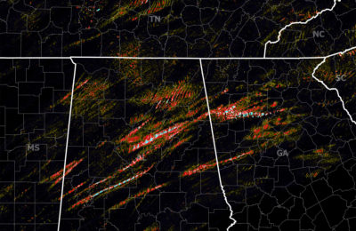
At least 54 tornadoes have been confirmed thus far (as of late yesterday) with the March 2012 tornado outbreak. Its place in history is yet unknown, but it will go down as one of March’s biggest and there’s a decent chance it goes into the record books as #1 for the month.
Below is a collection of a handful of the most gripping radar images of the March 2, 2012 storms as they were occurring.
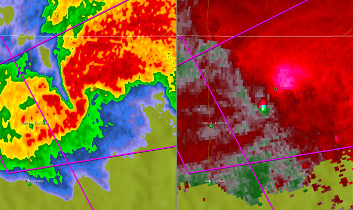 The Athens/Hazel Green, Alabama tornado as it was near Hazel Green during the morning of March 2.
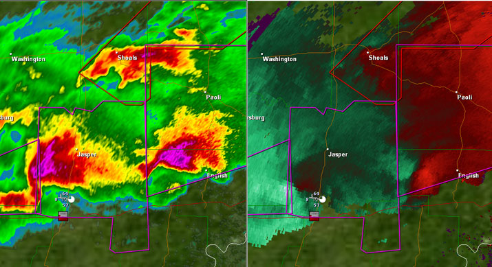 Twin supercells begin to develop during the early afternoon in southern Indiana.
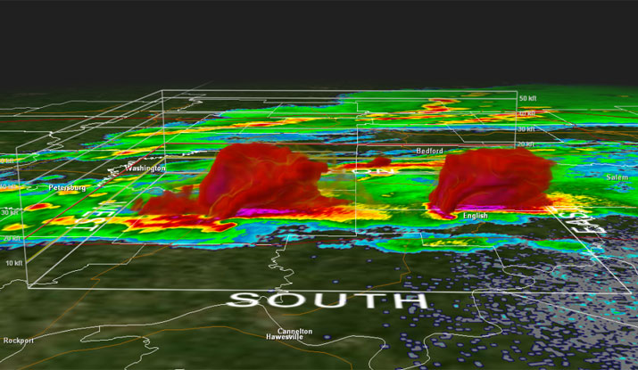 Another look at the southern Indiana supercells in their development phase.
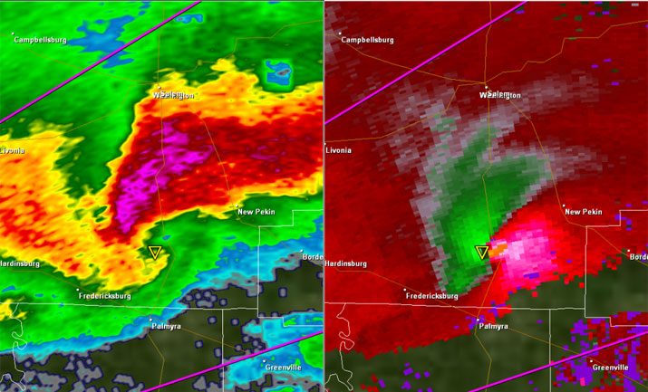 New Pekin and Borden, Indiana in the line of fire of a fierce storm producing confirmed tornadoes.
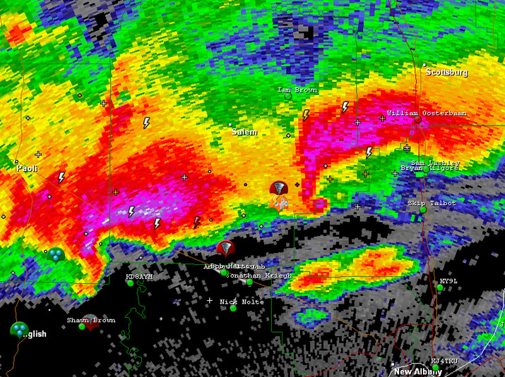 A debris ball is noted (supercell on right) via radar after the storm and tornado pass through New Pekin, Indiana.
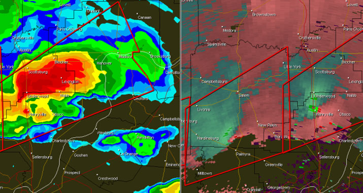 A storm producing a an EF-4 tornado passes right over Henryville, Indiana with the second fast on its heels.
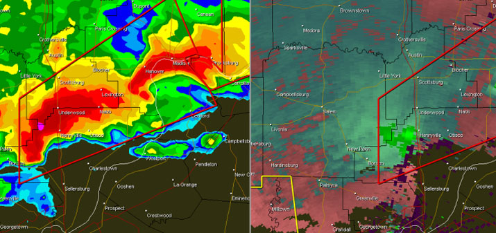 The second supercell follows the same general path of the first and passes Henryville, Indiana. It produces another Ef-1 tornado near Henryville.
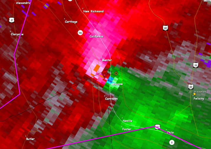 A very strong couplet seen on this storm relative velocity image passes along the Ohio/Kentucky state line.
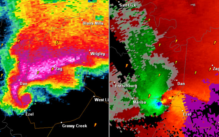 Tornadic cell passes through Menifee County, Kentucky and a debris ball is noted after passing Mariba, Ky. to the west of West Liberty, Ky.
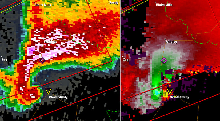 West Liberty, Kentucky is hit by the same EF-3 tornado that has a suspected path of around 90 miles.
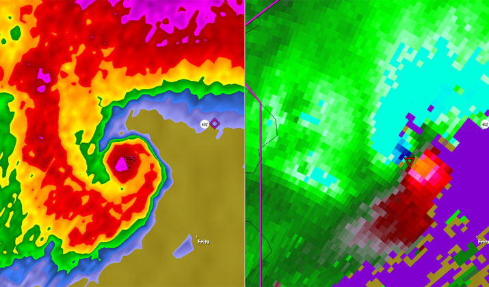 Textbook hook echo west of Salyersville, Kentucky.
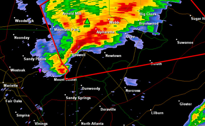 Tornado warned storm after passing through Marietta, Georgia in the northern Atlanta suburbs.
Images obtained from a storm tracking thread on AmericanWx. Follow U.S. Tornadoes on Facebook and Twitter.
