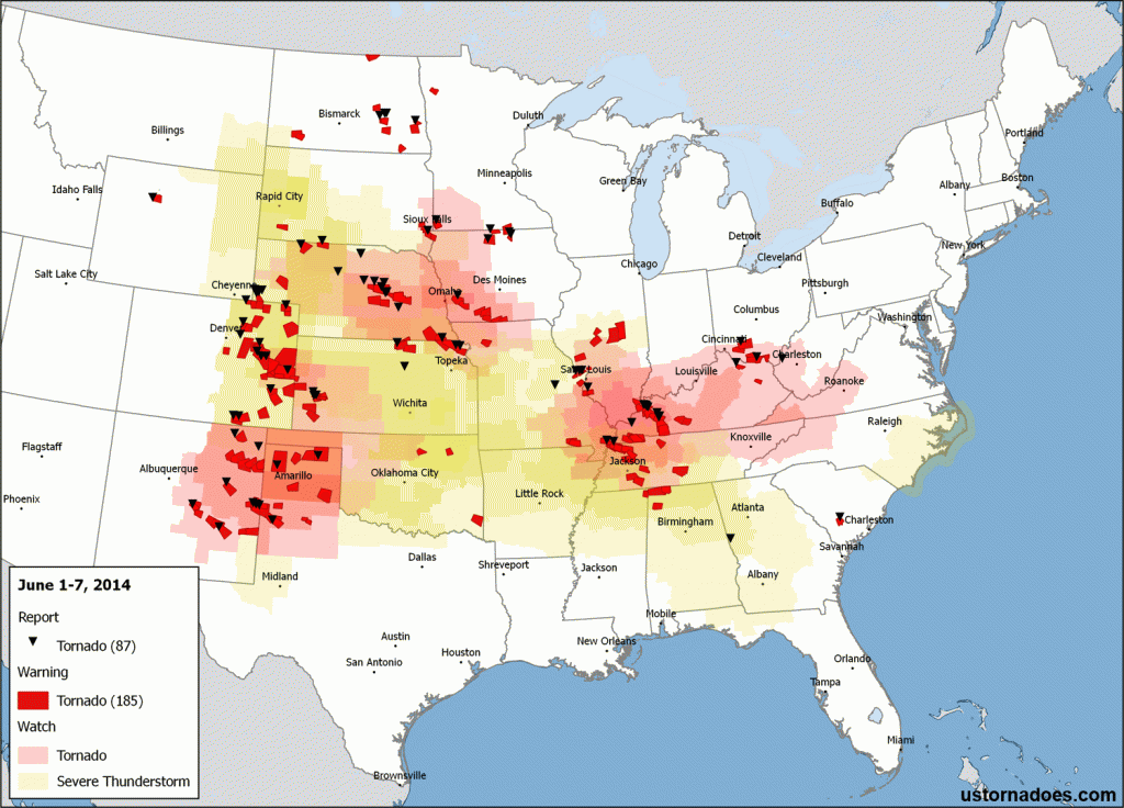
The first week of June was the most active when it comes to tornadoes since the final week of April which featured an outbreak across the southern United States.
Tornadoes were reported on all days, as is often typical for early June. While we begin to drop out of the peak of the peak for spring activity, days producing at least one tornado continue to remain very through the first half of the month.
Tornado “winners” on the week included the high Plains — centered on Colorado — as well as parts of the Mississippi and Ohio Valleys. For this week, and after another big day in Colorado on Sunday, we should continue to see at least small-scale tornado threats off and on.

June 1: Central and Northern Plains
A faster flow of winds aloft continued to pass over increased surface moisture, setting the stage for numerous thunderstorms over the center of the country. A few produced weak tornadoes to start the week, like the landspout seen below from North Dakota.
Another shot of the tornado near Jamestown earlier. Photo courtesy August Dockter. #ndwx #tornado pic.twitter.com/eqcp83drf1
— Aaron White (@AaronWhiteWDAY) June 2, 2014
@JimCantore @TWCBreaking @weatherchannel @WeatherNation @Basehunters Scott Peak and myself, north of Englewood, KS pic.twitter.com/02v8WKhGFm
— erik (@erikfox2000) June 2, 2014
June 3: Central Plains
June 3 ended up a “high risk” day for wind, but it also held considerable tornado threats that generally verified on the lower end of possibilities, and pretty close (I was skeptical) to our forecast.
A number of tornadoes were reported in the main risk zone across Nebraska, but many were never confirmed while others were brief and rain-wrapped for the most part. The biggest tornado of the day, an EF3 occurred after dark just across the NE/KS border in northeast Kansas.
SPC morning update highlights strong tornado risk from SD/NE border area running to SW IA. http://t.co/3Irax5NJeN pic.twitter.com/xxx6HVCCPI
— U.S. Tornadoes (@USTornadoes) June 3, 2014
Ansley, NE. pic.twitter.com/jgwJbW5F3X
— Edward Payne (@dwardpayne) June 3, 2014
June 4: Midwest/Ohio Valley and Colorado
Tornadoes were reported east of the Mississippi River on this day, including two that touched down in Kentucky during the evening. Several weak tornadoes were also reported in Colorado to the east of Denver near and after dark.
Funnel cloud this evening near New England, ND. Photo from Brian Loerzel. #ndwx pic.twitter.com/MuxyRZXvKl
— John Wheeler (@JohnWheelerWDAY) June 5, 2014
Tornado Warning on this cell for Elbert and Lincoln counties. #cowx pic.twitter.com/iLtvwm1emn
— Cory Reppenhagen (@CRepp7News) June 5, 2014
June 5: Northern Plains
A brief tornado threat popped up on June 5 across the upper Plains and Midwest as several supercells fired in the Sioux Falls, ND to Omaha, NE corridor before drifting around a bit. A number of funnel clouds occurred, along with an apparent tornado touchdown near Luverne, Minnesota as seen below.
Actual tornado from today northwest of town pic.twitter.com/HVYdXXaWXr
— Eric Woodley (@e21woodley) June 5, 2014
June 6: High Plains
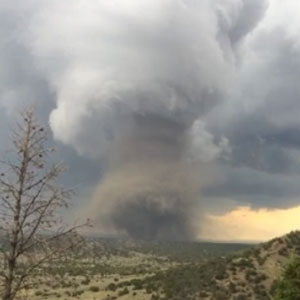
What 2014 has lacked in overall tornadoes, it seems to be making up in upslope severe thunderstorm and high-elevation tornadoes. On June 6, we saw a pretty classic high plains supercell event that stretched from Nebraska down into New Mexico and Texas. The tornado of the day arguably was one which touched down near Trinidad in Colorado. Mostly weak landspout tornadoes were reported elsewhere, but a large cone tornado was caught on video near Spearman, Texas during the evening.
.@AUSSKY shared images of today's tornado east of Trinidad, CO on Facebook: https://t.co/T9mhGJfmep pic.twitter.com/Vqvd6XDycT
— U.S. Tornadoes (@USTornadoes) June 7, 2014
Photo of tornado southwest of Fort Morgan, CO about 30 min ago #cowx pic.twitter.com/HynnsHxCe6
— Weather5280 (@weather5280) June 6, 2014
PHOTO: #Tornado kicking up ground debris near Sofia NM. Very weak.. LIVE at http://t.co/NYHSOgbKJV pic.twitter.com/GLOf76v5Is
— Daniel Shaw (@DanielShawAU) June 6, 2014
Tornado near Trinidad, Colorado. By jjs81082.
Tornado near Spearman, Texas. By Shalyn Phillips.
June 7: Highs Plains and Mississippi Valley
Multiple waves of atmospheric energy continued streaming by, causing isolated tornadoes in various locations across the country, including New Mexico and Missouri.
Tornado SW of corona. #nmwx pic.twitter.com/x81NbNN3ru
— Jennifer Palucki (@crimsonskies34) June 7, 2014
St Louis area tornado. By Dan Robinson of StormHighway.com.
More June tornadoes to come?
The easy answer to that is of course yes.
Overall, it appears this coming week will be less active than the last, but that’s partly because the next few days will be somewhat tame in the regions that have been seeing the most continual supercells and tornadoes recently. That’s because a system pushing east is temporarily cutting off moisture to the region, but that won’t last long.
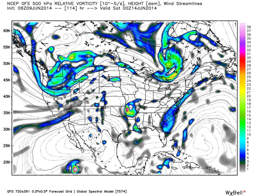
As we get later into the week, continued atmospheric waves pushing through the western U.S. should try to spill east out into the Plains by late this work week. Perhaps ultimately also further east as we get through next weekend.

The greatest odds for tornadoes may lie in the north, as is typical as we get further into summer. Subject to change as we close in though…
Latest posts by Ian Livingston (see all)
- Top tornado videos of 2023 - January 1, 2024
- March 31, 2023 tornado outbreak videos - March 31, 2023
- Top tornado videos of 2022 - December 31, 2022

